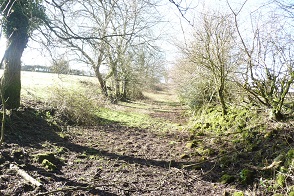
Rowden’s Lane
 Rowden’s Lane is now a barely discernible feature in East End opposite Lower East End Farm but it used to be a road that connected the East End Tithing to Shooters Bottom along with Purnell’s, Manning’s and Jenks Lanes. Rowden’s Lane is now a barely discernible feature in East End opposite Lower East End Farm but it used to be a road that connected the East End Tithing to Shooters Bottom along with Purnell’s, Manning’s and Jenks Lanes. |
 Rowden’s Lane is clearly shown in the 1740, 1794 and 1800 maps. It is not shown in the 1640 map but it may have been called Fields Lane in that map. The Rowdens name was retained in the name of a property that has been called Honewell Farm in this website which can just about be seen in the top right hand corner of this map. There is no reference to Rowdens Lane in the 18th century churchwarden or poor book but there are several references to Rowdens in the 1766 ledgers. Rowden’s Lane is clearly shown in the 1740, 1794 and 1800 maps. It is not shown in the 1640 map but it may have been called Fields Lane in that map. The Rowdens name was retained in the name of a property that has been called Honewell Farm in this website which can just about be seen in the top right hand corner of this map. There is no reference to Rowdens Lane in the 18th century churchwarden or poor book but there are several references to Rowdens in the 1766 ledgers. |
 Rowdens Lane borers onto field that have formed part of Hippisley and East End farms that can be seen from Rowdens Lane. Rowdens Lane borers onto field that have formed part of Hippisley and East End farms that can be seen from Rowdens Lane. |
Leave a Comment