| A Mr House, probably John House, was paying rates for the estate from about 1730 to 1760 according to the churchwarden and poor law records. A member of the York family was also listed as occupying part of Maltmead. |
| Some of Maltmead was part of Parsonage Farm in 1785 when Kingsmills sold it to the Hippisleys. It was then split into two, upper and lower Maltmead |
| The yellow spot identifies Whitemead that was probably another medieval common field. Whitemead may be a corruption of Wheat field. It is on the south side of Chew Down which is a surprisingly steep ridge so the more important wheat crop may have ben given the preferential ground whilst the barley used for malting was grown on the north of Chew Down. |
| The yellow spot identified a strip owned by the Anstee family which may have been part of the Kingsmills estate before 1785. |
| There were eight fields which included the name Maltmead in their name in 1840. They were occupied by several people but they were all in roughly the same place as shown in the 1794 map. |
| Sarah Curtis was occupying plot 190 in 1840 which is roughly the field marked Kingsmill next to the fields marked with green spots. |
| Plot 193 was owned and occupied by John Kerslake in 1840 and is marked as ‘House’ in 1794 which suggests that it was another part of the Kingsmill estate sold in 1785. It is believed John Keslake and Sarah Curtis were related. |
|
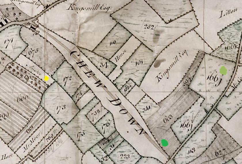 Some records suggest Maltmead was a farm but it was probably one of several groups of fields based on the traditional medieval common field systems. It is on the Ston Easton (North) side Chew Down and the various fields that form the modern Maltmead can be seen in the 1794 map marked with green spots.